River Deltas Are Sinking Faster Than Seas Are Rising, Endangering Hundreds of Millions
Many of the world's largest river deltas are sinking faster than the oceans are rising, creating a compounding threat to hundreds of millions of people who live on these vulnerable landscapes. Drawing on high-resolution satellite radar data, a sweeping new global study has mapped land subsidence across forty major deltas and concluded that human activities, especially groundwater extraction, diversion of sediment, and explosive urban growth, are the dominant drivers of the problem. The findings reframe the public conversation about sea level rise, which typically centers on melting glaciers and thermal expansion of the ocean, by showing that for many of the world's most populous coastal zones, the land beneath residents' feet is moving down even faster than the waterline is moving up.
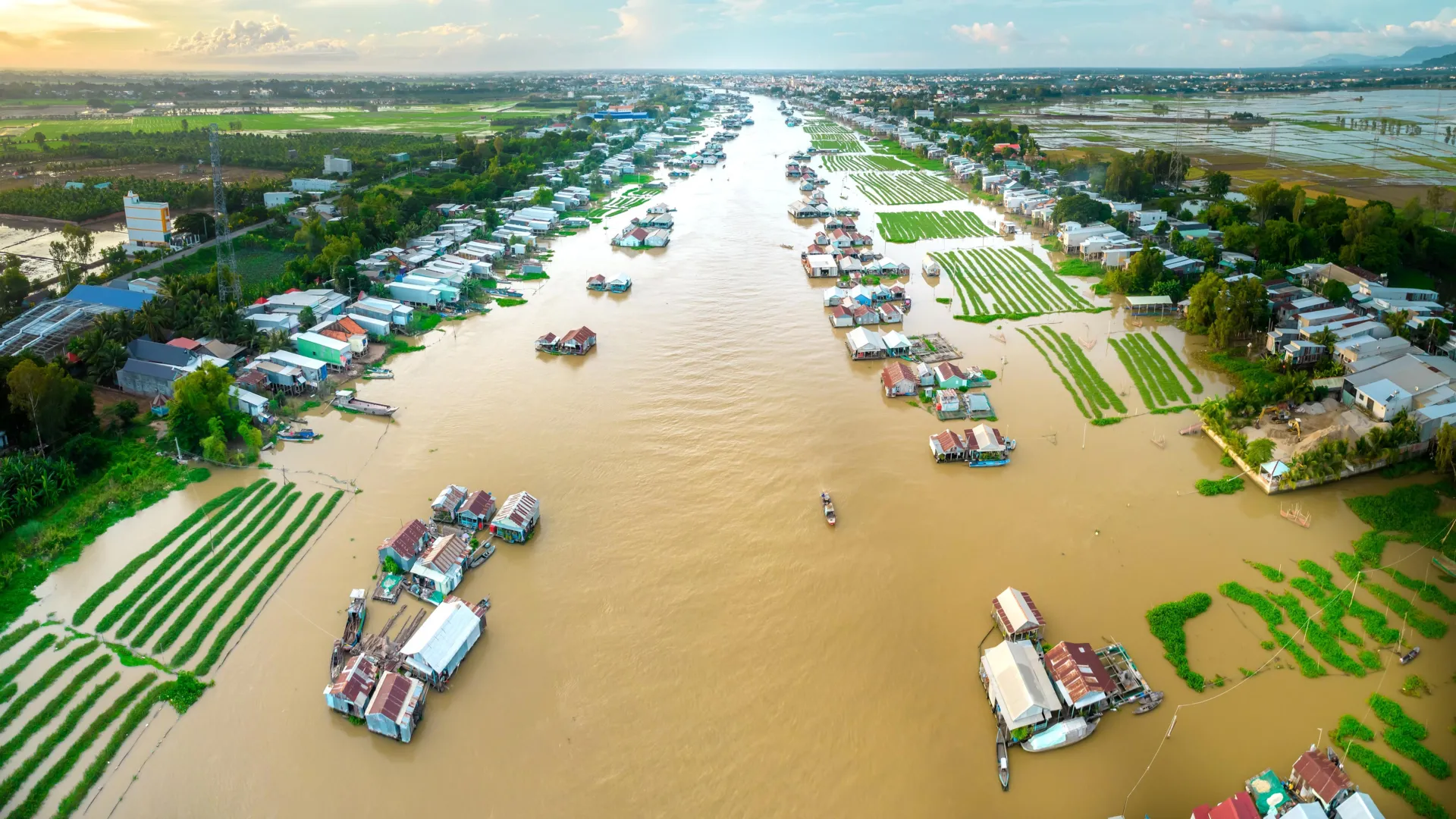
River deltas form where sediment-laden rivers meet the sea and deposit enough material to build up fertile lowlands. Throughout human history these deltas have attracted dense settlement because their flat topography, rich soils, and proximity to both ocean trade routes and inland waterways make them ideal places for agriculture, fishing, and commerce. The Nile Delta, the Ganges-Brahmaputra Delta, the Mekong Delta, and the Mississippi Delta together support economies and cultures that stretch back thousands of years. Today they are home to tens of millions of people each, and the collective population of the world's major deltas exceeds half a billion. Any threat that compromises their integrity therefore carries enormous humanitarian, economic, and ecological consequences.
Subsidence occurs when the ground loses support and compacts downward, and the new research documents multiple mechanisms driving the problem. Groundwater pumping for agriculture, industry, and municipal water supply removes fluid from porous sediments, causing the pore spaces to collapse. Extraction of oil and gas produces similar effects in deltas that host hydrocarbon reservoirs. Reduced sediment delivery from upstream dams and levees starves deltas of the new material that would normally replace whatever subsides naturally, since delta muds compact over time under their own weight. Urban loading, in which heavy buildings and paved infrastructure press down on soft sediments, adds further pressure. In many deltas these processes operate simultaneously and reinforce one another, producing subsidence rates of several centimeters per year in the most affected areas, dwarfing global mean sea level rise of roughly four millimeters per year.
The consequences of this combined sinking and rising are already visible. Saltwater intrusion contaminates freshwater aquifers and agricultural soils, rendering fields unable to support rice or other salt-sensitive crops. Storm surges push farther inland than they would otherwise, raising the likelihood of catastrophic flooding during tropical cyclones and extratropical storms. Infrastructure such as roads, railways, and wastewater systems buckles as the ground shifts unevenly beneath it, and urban districts built on reclaimed land begin to experience chronic flooding during routine high tides. Cultural heritage and ecosystems also suffer, with mangrove belts and coastal wetlands eroding more rapidly than they can recover. These pressures combine to push communities into painful choices about whether to rebuild in place, invest heavily in protective infrastructure, or contemplate managed retreat from the coastline.
Satellite radar observations proved central to the new assessment because they can measure ground motion with millimeter-scale precision across large areas and over long time periods. Interferometric synthetic aperture radar, known as InSAR, allows researchers to detect tiny changes in the distance between a satellite and the Earth's surface, producing detailed maps of where land is rising or falling. By applying these techniques uniformly across forty deltas, the authors could compare subsidence rates without the inconsistencies that arise when different studies use different in-situ methods. The resulting dataset reveals striking regional variations, with some Asian deltas subsiding at rates an order of magnitude faster than global sea level rise, while others experience more modest but still consequential sinking.
Policy responses to the findings will need to address both the immediate triggers of subsidence and the longer-term dynamics of sediment supply. Regulating groundwater withdrawals, shifting to alternative water sources, and managing urban growth on soft sediments can each slow the rate of sinking. Restoring sediment delivery requires reconsidering how dams, channelization projects, and flood control levees interact with the natural processes that built deltas in the first place, and some jurisdictions have begun experimenting with sediment diversions and controlled flooding to rebuild wetlands. Adaptation measures such as seawalls, pumping systems, and elevated infrastructure can protect against flooding in the near term, but they are costly and often unsustainable over the long run without complementary efforts to stabilize the ground. For hundreds of millions of delta residents, the study underscores that the climate crisis is not a distant abstraction measured only by tide gauges, but a layered and accelerating emergency rooted in the land beneath them. Ultimately, confronting delta subsidence will require coordinated action across water, energy, land use, and climate policy, along with meaningful cooperation between upstream and downstream jurisdictions that share river basins. The scale of the challenge is immense, yet the tools to diagnose it are better than ever, and this latest satellite-based assessment provides policymakers with a detailed map of where intervention is most urgent and what combination of measures stands the best chance of stabilizing these indispensable landscapes.