Scientists Identify More Than 3,100 Surging Glaciers Capable of Triggering Floods and Avalanches
A hidden and growing danger is emerging in the world's glaciers, and scientists have now mapped its scale for the first time. While most glaciers around the planet are losing mass and retreating in response to rising temperatures, a smaller but significant population behaves very differently. These so-called surging glaciers can suddenly accelerate by factors of ten, a hundred, or even a thousand, unleashing enormous volumes of ice and meltwater downslope in ways that can devastate valleys below. Researchers have now identified more than 3,100 such glaciers worldwide, with heavy concentrations in the Arctic and the Karakoram Mountains, where many communities lie directly in their path.
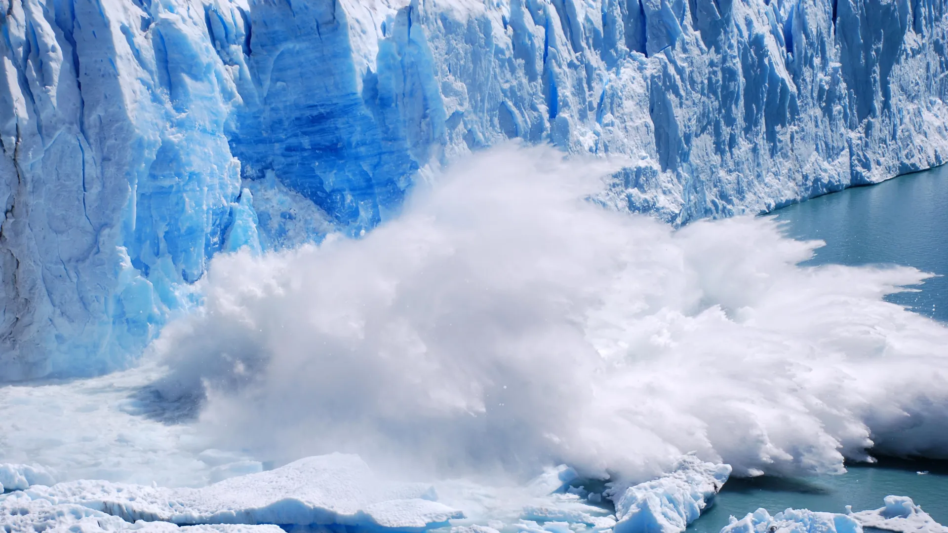
Glacier surging represents one of the most dramatic phenomena in modern cryosphere science. Unlike the slow, steady flow most glaciers exhibit year after year, surging glaciers go through cycles of relative quiet punctuated by sudden accelerations that can last months or a few years. During a surge, the glacier's front can advance by kilometers in a surprisingly short time, bulldozing through forests, reshaping river channels, and pushing ice into territory that had been clear for decades. The mechanisms behind surging are complex and involve the buildup of water at the base of the ice, thermal changes in basal ice layers, and shifts in the balance between sliding and deformation. Understanding these mechanisms has been a long-standing challenge in glaciology, and the new global inventory provides valuable data for testing competing theories.
The risks surging glaciers pose to nearby communities are substantial and multidimensional. When a glacier's tongue advances rapidly, it can dam rivers or tributaries, forming lakes behind its newly thickened front. These lakes can later release catastrophically when ice dams fail, producing glacial lake outburst floods that sweep away everything in their path. The sudden influx of ice and debris can also directly trigger avalanches, rock slides, and surges of sediment-laden water. Communities living in high mountain valleys, including many in northern Pakistan, western China, the Russian Arctic, Iceland, and parts of Alaska and Canada, face compounding hazards when multiple surging glaciers exist within a small area. Historical records include instances where entire villages were destroyed within hours by surge-related events.
Climate change is complicating the picture in ways researchers are still working to understand. Overall warming is shrinking glaciers and reducing ice volumes, but warming can also destabilize the internal plumbing of glaciers, alter the distribution of meltwater at their bases, and weaken ice-marginal lakes and moraines. Some studies suggest that surge cycles may become more frequent or more intense in certain regions as temperatures rise. Other research indicates that as glaciers lose enough mass, surging behavior could eventually diminish simply because there is not enough ice left to drive large-scale advances. Teasing apart these competing effects requires long-term monitoring, and that is precisely why the new global inventory is so valuable.
Satellite technology has revolutionized the study of glacier surges. Before the advent of modern remote sensing, glaciologists relied on field observations, historical photographs, and ground-based surveys that captured only a small sample of the world's ice. Today, a fleet of satellites measures glacier velocity, surface elevation, and terminus position worldwide. Radar instruments can see through clouds and darkness, which is critical for polar regions that are either in shadow or obscured by weather for much of the year. Machine learning algorithms can scan these vast data streams, identifying acceleration events that might otherwise go unnoticed. The new 3,100-glacier inventory was built by combining decades of imagery and applying automated detection methods that catalog surges even in remote locations.
Practical applications of the global inventory are already beginning to take shape. Governments in mountain regions can use the data to prioritize monitoring resources, focusing on the most at-risk glaciers and building early-warning systems that combine seismic sensors, stream-gauge measurements, and satellite surveillance. Emergency managers can develop evacuation plans tailored to specific surge scenarios, and infrastructure planners can design roads, bridges, and hydropower facilities with an awareness of surge-related risks. International organizations are also taking notice, as the inventory can inform climate adaptation funding decisions and help vulnerable communities access the resources they need to prepare. As the climate continues to change, the value of detailed, accurate, and globally consistent data about the cryosphere will only grow, offering a foundation for science, policy, and on-the-ground action in the mountains and the Arctic.
Public awareness and education campaigns are likely to play a critical role in translating the scientific findings into safer communities. Many residents of high mountain valleys have lived alongside glaciers for generations, but historical patterns alone no longer guarantee accurate expectations about future hazards. Local schools, community centers, and religious institutions are partnering with scientific organizations to share information about what surging glaciers look like, how to recognize warning signs, and what to do when an alert is issued. Media outlets in affected regions are devoting more coverage to glacier hazards, and social media networks allow information to travel rapidly across isolated valleys. Together with rigorous science and forward-looking policy, this kind of grassroots engagement builds the resilience that will be needed as the world's glaciers continue to respond to a changing climate in sometimes surprising ways.